******
Reading Hengeworld (four stars, review later) I learned the Negotiating Avebury project had a specific goal of (literal) POV variety in understanding the site from its outset. Archaeologists see sites in terms of overhead maps and cutaway views, while visitors navigate the megalithic sites largely by landmark. It dawned on current researchers that the builders and users of these sites had a perspective more similar to modern tourists than to modern archaeologists.
The exception of course would be during an actual dig, when the physical perspective of the excavators would be far more similar to their Neolithic ancestors. But digs are temporary and their participants few. So - now we can computer model them, creating virtual Aveburys and Newgranges, adjusting our size and perspective however we like. It should give us a picture more like the ancients saw.
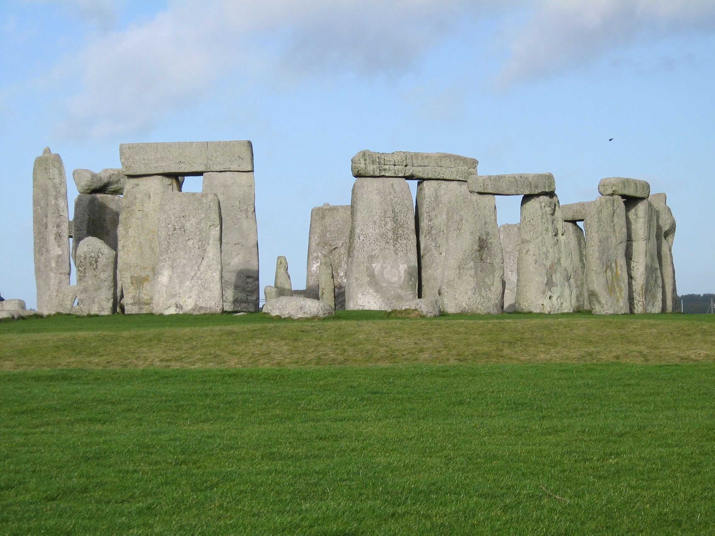
Most people have a primary vision of Stonehenge that looks like this.
But our secondary views will be like this

Or even this, giving context.

Neither of which would have been known to Neolithic people. (But see discussion in the comments.)
Reading that convinced me immediately that the wayfinding researchers were correct in focusing on cardinal directions as opposed to overhead maps as the contrasting method to landmark navigation. I had been thinking vaguely that because one could draw an overhead map of an area in the dirt to explain it to someone else, it was therefore possible that even before maps, people had done so, perhaps mostly on a local scale. I see now this is ridiculously wrong on my part.
1) Yes, you can draw a map in the dirt, but you can't carry it with you. Carrying a map in your head only comes from frequent use of them and reference to them while navigating. Until paper and printing were common, that frequency of use was exceedingly rare.
2) Early maps were clumsy affairs, revealing that their drafters had difficulty moving entirely to the overhead position. At ambiguous areas they seem to resort to a mixed perspective.
3) Cardinal directions integrate much more readily with landmarks, the other navigational strategy.
4) The idea of overhead visualisation of an area likely increased because of long-distance sea trade (relatively recent), surveying (only common the last few centuries), and the airplane and motorcar coming into common use (very recent). What seems natural for me, born in 1953, is historically quite unnatural.
I focused on Stonehenge because is is familiar to more people, but we are partial to Avebury here. One can walk among the stones, and the bank-and-ditch are still quite prominent. I thought that gave us more of a sense of what the original observers saw, but that's untrue. The ditch was far deeper, the bank a bit higher, and it was chalk, not turf. Since 1500 BC, perhaps, the pastoral, inhabited scene of today may have been more common, but when it was first dug, Avebury was more like this.

The image is from this wonderful Avebury site, though it doesn't kick modern druids half enough on the subject. (Talk about an idea that won't die, regardless of the data.) I'll be writing more about the megaliths this week.
The entire Wayfinding Series from 2011.
Introduction, with Yankee humor.
Update: A recent paper on spatial navigation.
More Wayfinding 2013
Note on Wayfinding 2012
Mapmaking
Spatial Memory
3 comments:
I'd think any place with mountains would give people some idea of overhead visualization. On a smaller scale, there are always tall trees and boys dared to climb them.
I wouldn't give up on the overhead map idea so readily. I think the difficulties in transition to modern mapping might be explainable by assuming that the 'map in the dirt' was done more as a planning reference (first we go here, then head in this direction to there), was not to scale, and might very well have been quite local. Another thing that popped into my head when you started with this series is that an overhead map view is very useful for laying out fields and irrigation systems when combined with landmarking but cardinal direction finding would be less useful in that situation.
I agree with Der Hahn about not giving up on overhead mapping too quickly. Wouldn't things like the Great White Horse and Nazca Lines indicate a certain amount of top-down spatial thinking?
Post a Comment